


zapreval Martini vrh

avdem
User
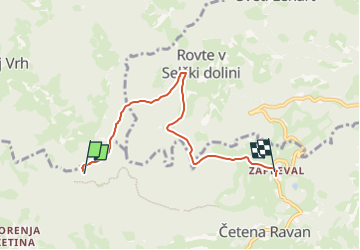

Length
5 km

Max alt
1146 m

Uphill gradient
31 m
Km-Effort
6.4 km

Min alt
858 m

Downhill gradient
306 m
Boucle
No
Creation date :
2024-08-13 08:18:36.666
Updated on :
2024-08-13 08:55:09.923
36m
Difficulty : Easy

FREE GPS app for hiking
 SityTrail
IGN / Geographical institutes
SityTrail Plus
The world is yours!
About
Trail Walking of 5 km to be discovered at Unknown, Unknown, Gorenja vas-Poljane. This trail is proposed by avdem.
Description
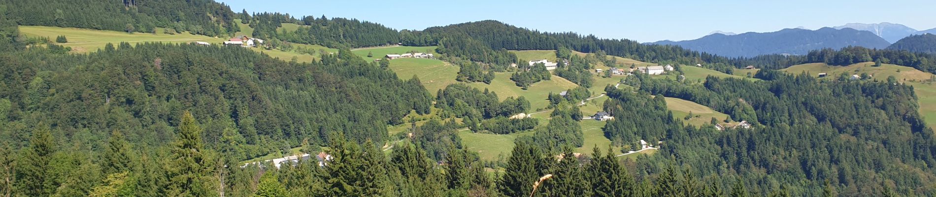
Sous bois
Photos

Positioning
Country:
Slovenia
Region :
Unknown
Department/Province :
Unknown
Municipality :
Gorenja vas-Poljane
Location:
Unknown
Start:(Dec)
Start:(UTM)
434742 ; 5113766 (33T) N.
Comments